Wednesday, September 14, 2022

 August 9, 2022 Back to the Trail!

After 11 months dreaming about completing the AT, we have arrived back in Maine and are ready to renew the Journey!We have driven to Bingham, Maine, which is a very sparsely populated part of  central Maine, staying in what I am calling the Guns and Ammo Motel, due to the sign outside the little strip motel built in the 1950s. We are near where we got in Caratunk, last year and will drive back up to the trailhead tomorrow. So far we have driven 1300 miles to get back to this spot. But have hiked 2042 miles to get here! Only 152 to go!


August 10   Miles 2042- 2054

A great start to the finish! Up early and back to Caratunk! Didn't know what to expect in today's 12 miles reentry to the AT. Always hard coming back when section hiking. It takes about 2 weeks to get your mountain legs back, and in 2 weeks we should be finished! Thru hikers long the way said section hiking is harder than thru hiking. It may be true. But sectioning is easier on my 71 year old self!

Cool humid morning, 62 degrees not too bad to start. My sweety accompanied us about 1.5 miles in. Great trail to start, doing 2 MPH, the fastest in a while. The opposite of my return last year on this very day on MT Washington.  Hiked in a fast time up Mt. Pleasant Pond, a 2500 foot mountain. Had a quick lunch, 7 miles done and just 5 to go. At lunch ran into a kind of creepy older guy coming south. Glad he was going south and not north. He said lots of odd things and didn't really listen to our comments about where he was headed. Always told to follow your gut when encountering other hikers. Strange guy.

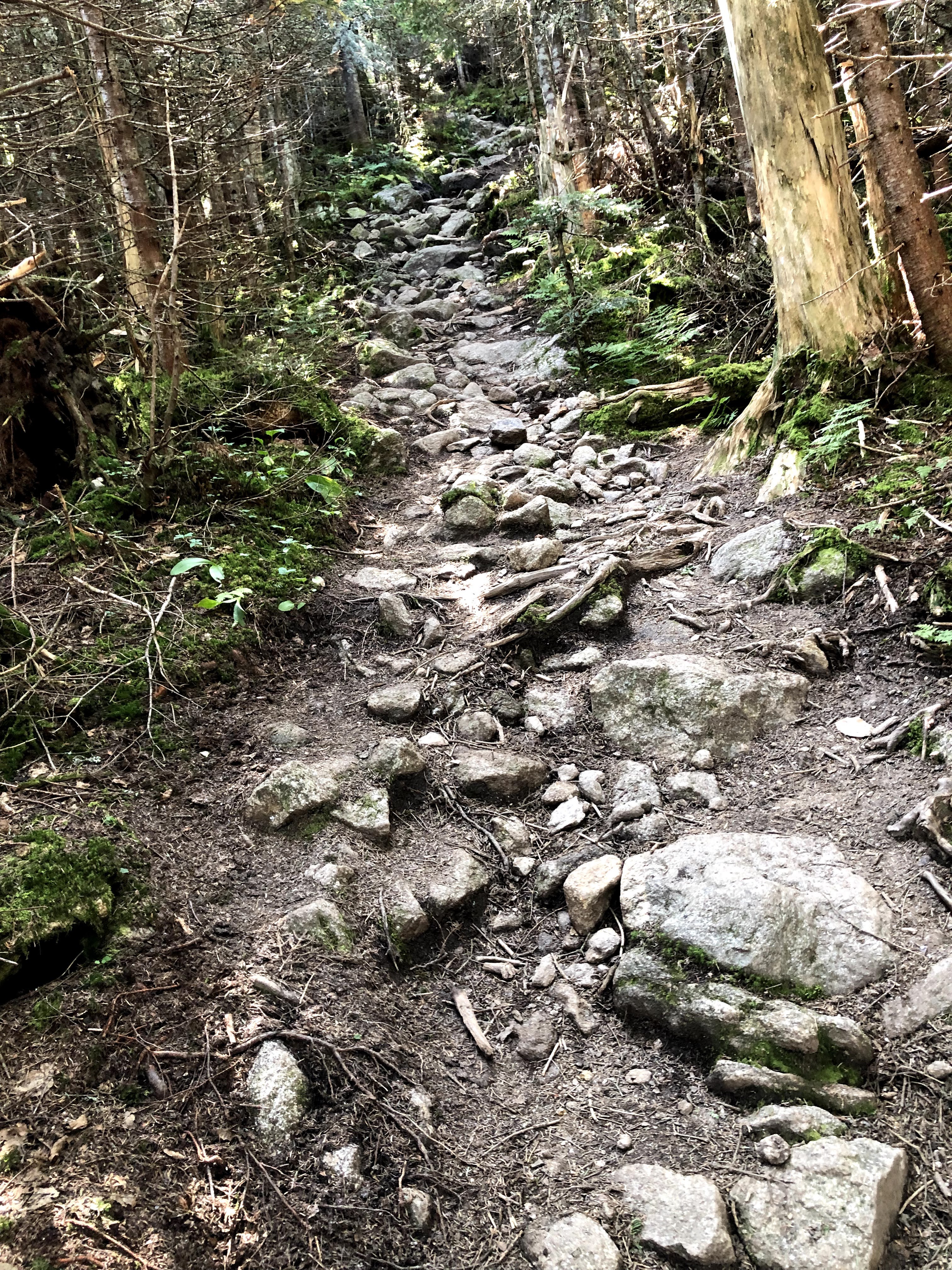
As always happens out here, the AT gods don't want you to have an easy day-so a slow slog down and up and down and up for 5 miles. Lots of rock and boulders to climb over and down-a baby White Mountain experience. Met an older couple coming south and they said the hike up was very difficult.

I think they are thru hikers. What's ahead for them is far worse than this. I feel for them. Finally at the bottom and the road and my sweety is there it greet us. Very tired at the end of the day. But happy to be back and excited! Hopefully my body will refresh by morning. Another mountain and our heavy packs tomorrow. Got to use day packs today. So much easier!!


August 11-12 Miles 2054-2078

Our two days hiking trip with full packs to get us to Monson, and the beginning of the 100 mile wilderness. Up one big mountain, 2600 foot Moxie Bald Mtn, but then down hill all the way to Monson. So much better than the way ups and downs of the last 400 miles. Hoping for clear hiking ahead like this. Had my very first ford of the entire AT hike on August 12. . The east branch of the Piscataquis River.  All along the way there has either been a foot bridge of some sort built or we could step on stones to cross every creek, stream or river. As well as a Canoe! But all of a sudden the AT wants a water experience-so off with the boots and on with the crocs. I had read about this earlier, so luckily was prepared. Kinda fun.


Did "cowboy" or stealth camping that night by a water source. Hadn't done that since way back years before. In the mid Atlantic states they don't allow it , and up in New England its typically too rocky and vertical to camp. Fun just throwing up the tent where ever we want, as long as you have water!


A nice flat out walking experience the second day out to my sweety at Monson! Part one of this concluding hike accomplished. A zero day ahead and then the 100 Mile Wilderness begins!

August 14  Mile 2078-2089

Began the 100 mile wilderness with my sweety walking for 3 miles with us. A ten mile day with a plan to hike that much each day to be done with this section by by August 23. 3 miles in, is a shelter across a difficult creek crossing with steepness and lots of rocks-Leeman Brook Lean-To. When arriving a day hiker looked down at the creek, where we were getting water and asked-"that water is safe to drink, right? We are up in the mountains." I said "NO, never drink untreated water out here." and we never have.

An actual hard hiking day. In fact every day out here has been hard-lots of PUDS-Pointless ups and downs!. Then my left blister heel nagged me all day. Didn't realize how bad it was til we had to ford another stream at the end of the day. and could see the blister band aid was gone and it was red underneath. Not good! I can't have another injury out here to keep me from finishing. So I put on a new Compeed blister patch with Neosporin and will hope for no infection.  I don't care if it hurts for the next 104 miles til we finish! But no infection. Then we get to the shelter and  open my food bag and what is this-My Mayonaise packet has exploded! What a mess and no real way to clean things up out here!

Cisco made a yummy dinner and then to bed in the Wilson Valley Lean to. When we got close to the lean to we hiked over some railroad tracks and I thought little of it. But during the night while trying to sleep and freight train came along and I thought it was going to come right through the shelter!

And snoring too! Long night!

August 15 Mile 2089-2098

Another hard hiking day. But I knew the first four days of the wilderness would be the typically hard stuff. Hiked up Barren Mountain, a 2600 foot mountain, with New Hampshire style ups, lots of bouldering and straight up verticals. Hope to be through with that soon. Worried about my heel blister,

but I took out my boot pad and it lowered my foot, so it barely rubbed. Should be ok. Along the way today, someone had put down in sticks-"100" 100 miles to go til the end! Loved seeing that! Made it to Cloud Pond Lean to. A very pretty spot, on top of Barren  Mountain. But almost a half mile off the trail, up and down over difficult terrain. We really dislike it when shelters are this far off, but a very pretty spot by a pond. 

\


August 16 Mile 2098-2109

Had four mountains to climb today. The main one Chairback. Another day I thought would never end. I made the mistake I do so often out here. I looked at the map and said, "oh today looks decent-a ridge walk." Ha, up and down and the downs turn into ups. So exhausted climbing over short mountain tops in the Chairback range. The profile of Chairback even looks like a chair. After 2100 miles, all us hikers, thru and section, say we've had enough and want this to be over. I was ready at the end of today. Not savoring this part. Just plain tough every single day. Maybe its my age? Anyway, at the top of Chairback some great views-green and blue as far as the eye can see. Sort of makes it all worthwhile.


Learned a new tern today-a MYTH hiker-Multi Year Thru Hiker. That's us. I like it! 13 summers since we started. Thought the 100 mile wilderness was inaccessible for 100 miles, but at mile 30 here is a major logging road-the Katahdin Iron Works road with the Gulf Hagas area nearby, a very scenic part of Maine we are told with lots of tourists. The trail ends today at a stream we will have to ford tomorrow.

We had planned to to tent camp on the other side tonight. But checking the weather, we see a major rain storm is coming in tomorrow and getting worse all day. With tomorrow being a day we need to climb a big mountain-3600 foot White Cap-the last big climb before Katahdin, it would be a miserable day hiking day in big rain. So we opted to return to Monson and wait out the storm and come back Thursday. Doesn't see to mess up the schedule and let's me tend to my blisters and repack our gear for the next 70 miles. Got another blister on my right heel this time. Can't believe I'm still getting blisters after nearly 70 miles of hiking. We did see the crashed airplane today by the trail. Very interesting. Happened about 40 years ago, and no one was hurt.

August 17-Zero Day

August 18 Mile 2109-2122

We got up early and drove the hour back to the stream. The heavy rain raised the stream quite a bit, so fording it was a  bit of a challenge. Got across and hiked off for the day. The rain was supposed to end in the morning, but it persisted all day and the trails were flooded all day. My boots and socks were soaked all the way, with no way to dry out. We climbed 4100 vertical feet today-4 mountain tops, and with lots of clouds, no views. So White Cap was a bust for viewing-but that happens out here. And it was another little Mt Washington-lots of rocks. Roots and Rocks-that's been Maine.

We finally get to our shelter-Logan Brook and it is very full due to the wet weather and the camping areas are all muddy. So the other hikers let us squeeze in for the night. There are several young thru hikers-and as they always do, they boast to each other how fast they are and how many miles they do a day. One said he does 35 miles a day, I don't see how that can be sustained. If so he should have finished 2 months ago! A past thru hiker was there redoing the 100 mile wilderness. One of the younger thru hikers asked her-"Does it get easy from this point on to the finish." Which I thought was an odd question from someone who has done over 2100 miles-You would certainly gotten pretty tough by this point. Anyway her answer was classic-" It doesn't get easy, but it gets easier. Nothing is easy on the AT."

Very true words. So we get down to dinner, a wet day and we say it's time to eat. But Cisco can't find his spoon. Its the only utensil he and I have. So, in true AT fashion, we share my spoon. Good dinner and to bed. And its still raining. 

August 19 Mile 2122-2134 

In studying the maps going back to last year, I noted with anticipation, that once I got to Mile 2122 and Logan Brook Lean to, I was home free, that is it would basically be down hill from here and no more crazy high ups and downs. A few ups, but the worst would be behind us. About 60 miles of pleasant hiking "walk in the woods" terrain until Katahdin. Not exactly that easy, but a nice hiking day ahead.

I also decided we would pick up the pace and finish in 4 days and not 5, getting to Abol Bridge and Baxter Park on Monday. This would require 4 -15 mile days-alot with a pack, but with easier terrain, doable for me. So off we go and day one is good. Maybe a total of 1000 feet of elevation, just one 400 hill, not mountain, as Cisco keeps reminding me, and downhill and flat there after. Still rocks and roots, but I am ok with this.  

So after about 12 miles or so, we make it to Cooper Brook Falls Lean to-a most beautiful spot by a wide stream, and probably the prettiest stream we have ever camped near. We set up tents by the stream and enjoyed the afternoon. Ate dinner and early to bed. Lots of other hikers here. Many Sobos, who I felt very sorry-I keep thinking about where they have to go, and I don't want to go back. But in perspective, I am 71 and they are like 25, so for them it's pretty not a big deal. Lots of fordings on this section.

Never forded a river until this trip. Now probably half a dozen. And one very scary. A person could drown out here!

August 20 Mile 2134-2149

We make it to the generic State Campsite by Pemadumcook Lake by late afternoon and do our primitive tent camping near the lake. Hiked by lots of pretty lakes today, and very little elevation gain. No one else nearby by and beautiful weather. During the night I get out of the tent to observe the night sky, as this is a dark sky official area. Beautiful starlight. 

August 21 Mile 2149-2164

A very long hiking day. Expected it to be easier-Ha! Fell twice.  Hiked along  Nahmakanta Lake. So far ok. But then came Nesuntabunt Mtn. On the map only 750 feet up, but on a warm day, it kicked my "bunt". So tired! 

It was straight up! A bunch of other thru hikers got to the top as we were eating lunch there, and they said how tough it was too. Made me feel better, but I was really drained. At the end of the day, we hiked up Rainbow Stream-It was the most beautiful stream I have seen on this entire 2164 mile hike! Rocks and roots and roots and rocks, again! Early in the day my boots finally dried out from 3 days ago. But, fording a  stream, stepping on old logs and branches, my right foot boot went splash into the water. Soaking wet again. We didn't arrive at the Rainbow Spring Lean to until 6:00 pm. What a long day. Exhausted, tenting again tonight. But this will be our very last night of tent camping. How strange.

After nearly 200 days on the trail, this is our last night of all our rituals-Tea on arrival, Cisco getting water, me treating it, Cisco going through our food bags and fixing dinner, eating on a log or a rock,

cleaning up our dishes. Eating a Snickers bar, brushing our teeth and then to bed by 7:30. With all the rocks and roots, its been a great time together. But 15 miles tomorrow and the dreaded 100 mile wilderness is finished. Hard to believe we are at this point after so many years and miles.

August 22 Mile 2164-2179

Up at 5:30 and excited for the day to come. Not a bad of of hiking, the same roots and rocks, but only about a total of 1000 feet of elevation all day and we come to the end of the Wilderness at the Golden Road and Abol Bridge, a destination I have dreamed of for 12 years. And we are here! But its just a dusty rural road. No fanfare, no real feeling that you are anywhere special. Just another dusty road. And the bridge, just another bridge, indistinguishable from any other road bridge. I guess I was expecting some grand design to welcome us here. Oh well. My sweety is there to meet us and we walk the road down to near the Baxter Park entrance for our conclusion in a few days. But first a zero day in Millinocket, a steak dinner, a pizza dinner and two packless days to finish! So excited!

August 23 Zero Day in Millinocket

August 24 Mile 2179-2189

So close! Back to the trail from Millinocket, and a quick flat walk to the Baxter Park entrance. Meet the ranger there and check in. Then an uneventful 10 mile flat hike through the park to the Katahdin Stream campground area where we will start the summit to Katahdin the next day. Hiked along the beautiful Nesowadnehunk Stream for about 5 miles, then through woods and by ponds in the park. Very nice.

Rain lightly began to fall when we reached the end of the short day hike. We were at the bottom of the mountain, but couldn't see it. The parking lot was pretty small. Luckily everything had fallen into place for the conclusion of our hike. We had to have a place or parking reservation to summit. Couldn't get a parking reservation, but was able to secure a cabin on Kidney Pond for 2 nights, about 15 minutes from this parking lot. With my Sweety and our car, it was easy way to get there. Met a ranger who had to give us our special hiking permits to summit the next day. Signed up with the rain falling and off to our cabin for the afternoon and night. Good weather expected for the next day. So glad!  


August 25 Mile 2189-2194 The End

Nervous as usual Not knowing what to expect, but have read about all the bouldering we will need to do. 4000 foot elevation climb and a total of 5.2 miles to the top. Then  5.2 miles down, but via another trail. The AT ends at the end of the Hunt Trail. Either have to go up or down Hunt to be official. Rather go up it, don't like descending through boulders.

The first 2 miles or so is delightful. Gentle up, by waterfalls and Katahdin Stream. Then a half mile or so climbing stone steps. Not so bad. Watched some videos of folks summiting and it didn't look any worse than the Whites in NH. But then it hits you! The Boulder field begins where the treeline ends. Up to this point it reminded me of much of the Whites-straight up hiking over lots of rocks. Not terrible.

Now it begins. We reach a point where the boulder field is like nothing I have yet experienced. So glad I just have a light day pack. Have to pull myself over boulders and sharp rocks. Don't want to look down or to my side, as it is straight down into the side of this very steep 5000 foot mountain. Tallest in Maine. Got to a chin up bar and had to pull myself over. Very tough. Then lots of very steep and very sharp rocks and boulders to climb over for a mile or so. Cisco told me later that he had read in our cabin journal that an older couple attempted this hike earlier in the month and gave up at this point, as it was just too hard. Glad I didn't wait any longer to try!

After climbing and climbing, seeing false summit after false summit as so often happens out here. A couple coming down says to me, "You are almost there!" And so I was. A little more effort and we have made it to the Gateway and the Tableland! Flatness! Eons ago a glacier sliced off the top of the mountain creating a rock strewn flat landscape for a mile or so-treeless, so you could see Baxter Peak our long sought objective. On we walked, very excited now as were so close. Went by Thoreau Springs,

where Thoreau had made it back around 1842 and drank for the water here. Cisco got us water from the Spring as well. Not sure how he made it so far without blazes. I sure needed them or I would have been a goner. Read later that 60 people have died on this mountain in the last 90 years, two as recently as 2020.

Glad I didn't know that too! Anyway just about a mile or so to go. Up through a rocky trail now, and we could see lots of people on the peak. The weather was still great. Cloudy but comfortable. As long as no rain I was happy. Up and up a bit. Came across some teenagers and one had twisted her ankle very badly, and it was swelling while a companion was wrapping it with a bandage. We asked if we could help, but they said they were ok and gave our condolences and moved on.

Then we were there! The peak! The end! The stuff that hikers' dreams are made of. We hugged the famous Katahdin sign. And it was finished.

When we left the cabin that morning, Cisco forgot his phone, my sweety forgot her phone. I didn't carry my Iphone out here, but had my burner phone. We had no other camera. Cisco carried the burner phone as we went up the mountain. Climbing over the boulders  the screen somehow hit the rocks and the screen was damaged to the point that the phone was useless. What would we do? We would need to ask someone to take our picture at the famous sign-All hikers have it somewhere in their possessions.


And as always, you can't make the distance out here without the help of strangers. We asked two hikers to take our picture, exchanged email addresses and hoped they would remember to send when they got a signal. They did and we appreciated their help so much.

We then ate our lunch by the rocks near the sign. It took us right at 5 hours to summit-6:40 AM to 11:40 AM. So happy with our speed and success. After a celebratory lunch and much happy discussion we headed down. Taking the advice of the AT person in Monson, we decided to take the Saddle Trail and the Chimney Pond Trail down to meet my Sweety at Roaring Brook Campground. I could not go down that boulder field and didn't need to. The AT was concluded. Wow! But what a tough way down- rock slide for two miles. It took as long to get down as to get up and I was exhausted. I thought it would never end. Again, rocks and roots. Steep downs. Mud pits. But, I was so happy the trail was done!

What a grand adventure!!! Many thanks to all that made it possible-Known and unknown


.


Friday, September 10, 2021

 Aug 11 mile 1866-1873


Over night sleeping in the Hut was not good. Couldn’t sleep well at all. Worried over how exhausted I was and 
now had great pains in my thigh muscles. Could barely get up and down with much pain. Very odd- in the past
 it would be my knees, knees ok, but now my thighs? How am I ever going to hike out of here? I am at a very low 
point. And the trail out is super tough. To begin a half mile straight up 575 feet gain over a big pile of rocks!
 Anyway contemplating maybe I am too old for this.
Next morning I talk to Cisco and he gives me a pep talk. So I get my act together and after a poor
 breakfast we head out at 7:30. To make me feel better Cisco tells me of a group of 9  60+ year olds
 that had planned a hike of 7.5 miles over the top of Mt Washington to leave at 6:00 am. They got halfway up the
 .1/3 mile trail that we hiked down yesterday and 7 of them decided to turn back as it was just too tough.
Up to the top of Mt Madison we then went.


It was grueling, all rock and very windy. A very tough climb.
 But glad it was the first thing in the morning. Got to the ridge on top and lots of wind and then rain!! 
Stopped to put on my rain jacket,  but then my pants were soaked. Going as fast as I could with my sore
 thighs to get through the rain and off the ridge. Don’t want to get too soaked, which happened, and
 concerned about lightning, but got down from the ridge top and out of the rain shower. 
Then the long hike down Mt Madison and traversing numerous ups over rocky points. 
Even the downs are up on Mt Washington.
Took me from 7:30 am to 1:30- 6 hours to go 3 miles today. That was the hardest part of the hike, or 
rock scrambling. Then we went 3 more miles to meet my Sweety at a rendezvous point on the trail and 
we walked out together. The last 5 miles were a pretty typical mountain trail, but with my suffering thighs
 I could only go a mile an hour. Pretty slow! But at the days end, near sunset we arrived at Pinkham Notch 
and my Sweety had packed Chips, Guacamole, and the local Long Trail Ale. A great end to a tough two days.

August 12 Zero Day
We’ll had originally planned to hike over Wildcat Mtn today, but as I have learned, planning can be 
pretty useless out here. Each day brings new issues, weather, trail conditions, health. After two days 
of grueling ups and downs over miles of unrelenting rocks and boulders my poor thigh muscles cried,
 Enough! I could barely step  over the curb this morning. So we took a day off and will take off Friday too. 
Hopefully, by Saturday I’ll be fit for duty, but if not…
The day was spent as a typical Zero Day, replenishing supplies and buying needed clothes for 
the continued hike. And eating and enjoying this very nice hotel. Leaving here tomorrow to go to Gorham,  
NH and another motel. Hope to feel better then. And a very hot day today, mid 90s, so glad we weren’t 


hiking, way too hot for that!

 Aug 13 Another Zero Day
Packed up all our stuff and moved north to a little motel in Gorham. Spent the morning hanging
 out at a beautiful creek with cold water pouring over a billion rock slabs. 
Here the rocks are fine, as I don’t half to hike over them.
My thighs are feeling better today. It’s a beautiful sunny day, 
but very hot, in the low 90s. Very unusual for northern NH. So glad I took another day off to rest my legs. 
Hiking in high heat is miserable and dangerous.
Hope to head out Saturday, but rain is expected then and concerned about going up Wildcat in the rain. 
Not a good idea. So will wait to get a forecast to decide our fate. After tomorrow cooler weather is on the 
way and no rain. But we are itching to go and I feel my legs will be ok on Saturday. Just have to wait and see.

Aug 14. Nero Day (Near Zero) 1873-1874
Rain was predicted for today and as our next climb is up Wildcat Mt. noted for being very steep with much 
sheet rock, I thought it best to wait it out another day until tomorrow when the weather is to be perfect 
with clear skies and lower temperatures. Still, antsy to get going today. 
My thighs are feeling so much better, while still a little sore, should be good for hiking. 
Shopped today and repacked our packs for three days hiking-about 21 miles. 
Did find where we could walk 1 mile of the next section at least today. 
And did that, up a road by a lake and into the woods. Nice. So a “Nero Day!”
Looking forward to tomorrow.

Aug 15 Mile 1873-1879

Today is the big day! Hike the Wildcat Mountains on the AT.  Quite nervous as to what to expect. 
Have read this is a “very strenuous trail” and it has been listed as one of the hardest parts of the AT.
 So planning to hike just 6 miles, hoping my thighs will be ok, and hiking to the last Hut in NH.
Camping on your own is near impossible here due to the rocks and steep topography.
Anyway, up early before 6:00 am at the Moose Brook Inn and a quick breakfast and my Sweety
 drives us down to the Pinkham Notch trail center to get back on the trail. It’s a perfect day to hike.
 Cool temperatures and no sign of rain.
She hiked with us the first mile which is pretty flat (rocks included of course) and by two very pretty ponds.
Then she leaves us as the trail turns into the Wildcat it is- 2000 feet straight up over 2 miles- 
no switchbacks here and lots of rocks and boulders.
This is not hiking, this is perhaps the closest thing I will ever do to Free Soloing. Seriously it was nuts! 
Pulling myself over boulders while carrying a pretty full pack. It was a long morning.
Up up up! And a bit scary as we came upon open ledges and place where you do want to lose you balance. 
Yeah, definitely one of the top most difficult climbs out here.  After 3 hours we finally ascend the
 first of the Wildcat mountain tops.  there are 5, E,D,C,B, and A. At D we come out of to a Ski Area! 
And there is the ski lifts disgorging tourist after tourist, always a strange sight to see after being in the woods.
 We ate our Subway sandwich purchased the night before, on the windy top and were happy to see we
 had a trash can to throw away our wrappers. Didn’t have to carry them for three days!
Then back on the trail and up and down and up and down until about 2 hours later we finally got to Wildcat A, 
the last peak of the day and all over 4000 feet. That’s a thing here, to climb the 48 4000 footers in NH.
 I’ll leave that to the locals. While hiking I see this guy come by, and it the guy from the video I 
watched talking about this trail! We talk a bit and the off he goes! Then comes the 1000 ft 1 mile
 straight down. Not good for me. As much as the ups are make my pulse rate soar to 140, the 
downs are so severe I step so slowly and carefully not to fall. When young you skip down these
 things gleefully, “I’m invulnerable” At 70, it’s “I don’t care how long it takes, just don’t get hurt!”.
 Finally around 4 I make it to the Hut area and Cisco has been patiently waiting for me for 30 minutes.
 He is a good son. Go to the Room and fall asleep til dinner and have a pleasant evening. 
So far no real aches and pains and feel a great sense of accomplishment. 168 stories, 


2800 feet of vertical gain, 19,000 steps! Whew! NH is hard and I will not miss it! To bed!

Aug 16 Mile 1879-1887
Wow! NH is tough and won’t give up! I thought,
with Wildcat done we could have an easier day!
It was as tough and longer than yesterday- going  about 8 miles all in. The morning was another long up-
1500 feet, I was tired when we came out, but I thought, we’ll there not to many more ups today. But today it 
wasn’t the up it was the insane downs.
Coming off mountain tops, like the various Carters, the trail was boulders you had to climb or in my
 case slide down. It was nuts!! This is not hiking! 
I didn’t sign up for rock climbing. It took all my energy to make it through the day. I
 don’t know what tomorrow will bring, but 8 miles out to the road to meet my Sweety!
On the otherhand it was a beautiful hiking day.
 Visibility everywhere from the tops of all the mountains we summited.
 And all the trees are Christmas trees, so the air is so fragrant. And moss and ferns throughout.
 But almost no birds!
Where are they? I did see a hawk, I think?
Anyway finally made IMP Shelter at 5:30. Nine hours to go 8 miles. 
Not so good. But I went very slowly as to not get hurt.
Cisco made our yummy dinner and we chatted with the 
other hikers staying here at the shelter.
Very nice evening. I am pooped and ready for bed!


Aug 17 Mile 1887-1895

Out of the woods and down to Highway 2 at Gorham. This is a milestone, we are now officially through the
 White Mountains. I will not miss them. And only about 15 miles from Maine. It was a more normal hiking day. 
A long up as usual over Mt Moriah with more beautiful views, then a bit steep down a thousand feet or so, 
to, amazingly, a nice mountain trail for the last 3 miles. I finally made some good time with Cisco’s encouragement!
Now the next step is a big one-leaving NH and getting on the Mahoosuc Trail, 
considered the toughest part of the AT. But it will have to wait a couple of days. We decided
 to zero one day, then the remnants of Hurricane Fred were to past through on Thursday, which it did. 
Don’t really relish having the first day of a tough 4 day hike with heavy rainfall. 
So decided to go off early Friday morning, Aug 20. But had to move our location to a very nice AirBnB 
house in Andover Maine.
Lots of room and this will be my Sweety’s place for a week while we hike. 


Excited about the next 4 days as we will finally be able to hike into Maine.
So finally, GA to ME on the AT may be a reality.

Aug 20 Mile 1895-1906
Back to Gorham, hopefully for the last time. Ok place, but not our favorite. Left Highway 2 for what we thought 
would be a fairly moderate hike. Wrong as usual. After a not too bad 1800 foot climb,
 over a few miles still have the same old NH rocks and boulders. Another tough hiking day 
but need it to get out of NH! Even though the mountains are a little smaller out of the Whites, 
they are still hard. I think it’s NH saying, “we’re gonna kick your butt all the way to Maine!”
And they do. But now we are only 4.5 miles from the promised land and we passed over Mile 1900  today. 
The biggest thrill of the day was Cisco saw a porcupine. Very cool it was rubbing on a tree. I stayed far away.,
The only other news was this was mostly an ugly trail. Rutted out, some times hiking through a creek or mud pit.
 Little trail maintenance, lots of little trees sticking out over the trail so you could barely see it. 
And of course constantly stepping over big rocks of ascending or descending boulders.
 I was exhausted early in the day and we had the longest day yet with full packs. 
11 miles and the AT blazes were pretty scarce. Often I’d call ahead to Cisco, 
“am I going the right way?”
Finally got to Gentian Pond shelter at 6:15 after 11 hours of hiking! 
Very slow but my normal 1 mile per hour. Maybe Maine will be faster?

Aug 21-Mile -1906-1916

Slowest hike of my life. Took me 12 hours-7:30 am to 7:30 pm almost dark, to hike on the Mahoosic Trail 
over several mountains that I can’t remember to get to our shelter spot-Full Goose Shelter. 
Up and down and up and down.
It took me forever but luckily the weather held.
The most noteworthy event of the day was we entered Maine! Our goal for 11 years.
 Not we can say we have hiked from Ga to ME, just like the t shirts say about the AT.
 We took a picture to commemorate the event, but the hiking day so long we didn’t have time to celebrate. 
Cisco got to the shelter-called Lean To up here- about 30 minutes ahead of me so
 he could find me a spot which was good as the shelter was full. Ate a little dinner and to bed ASAP. So tired!

Aug 22 Mile 1916-1921

Big day today. “Toughest Mile on the AT” ahead-
Mahoosic Notch a one mile boulder field. And then a 1500 foot straight climb on the Mahoosic Arm. 
But only a 5 mile day, but expect it to take all day due to the Notch. And it did.
Up very early, but it was raining, and had all night. I had another hiker tell me, “don’t hike the Mahoosic Notch if
 it’s raining.” Oh well, what are we to do. It rains out here and and if you are out in a four day section you 
have to keep going. Otherwise your food runs out. So I put on my rain pants and rain jacket and headed out.
And it rained. We got to the Notch fairly quickly.
 And then an excruciating 3 hours and fifteen minutes later we emerged. Over boulders under boulders. 


Many times I had to hoist myself up and didn’t know if I was going to make it.Cisco 
had to assist me several times. Couldn’t have gotten through here without him or any of this trail.
 It was very tiring and monotonous. More technical stuff as they call it, that’s not really hiking. 
The caretaker at the Lean To tonight said 3 hikers had serious injuries this year on the Notch. 
Glad we got through ok. A few falls today on slippery stuff. But nothing serious. 
Anyway, finally finished around noon, ate our lunch on a wet rock and then headed up the Mahoosic Arm. 
It was straight up 1500 feet in about a mile or so. Very slick rocks and big slab expanses
like Stone Mtn. But very slick and had to grab on to every tree on the way up to keep from falling.
A very treacherous day and one I do not want to revisit. In fact this trip so far has been so difficult that 
I will not be singing the Beatles song “Yesterday” I do not want to go back. I do not long for yesterday on 
this hike.
Anyway, we got up the mountain, and it was not as hard as my imagination had described for me.
Got to the top with a cold wind and rain storm and got to the lean to by 4:00. Very happy getting here.
 I was soaked to the skin, even with my rain gear and my pack too. My boots are totally soaked 
through as well as my socks.. Probably won’t dry out much for tomorrow.  Though most 
other items in my pack stayed dry. And they just don’t dry out very well out here. Too humid and wet.
 Cisco made hot tea and dinner to warm us up and now we are
In our sleeping bags at 6:00 pm. How nice this is.
Tomorrow Hurricane Henri is be coming through here so we need to get up early and 
get down to Grafton Notch for my Sweety to pick us up.
 It’s only 4.5 miles, but we plan to get going early to hopefully beat the storm.

Aug 23 1921-1925
Rain, Rain, Rain! Wet all the way to the bone.
Wettest I have ever been! So it rained all night, not hurricane rain, just normal mountain rain 
and very windy too. We are all cozy in the shelter, but knew we had to get up extra early and 
get going to avoid the coming hurricane. Or so we thought.  And it’s weird with all these hikers 
stuffed the shelter Covid rarely crossed my mind. So happy for vaccinations!
In the morning almost all my clothes were wet and my boots soaked through. 
Pack and contents as well. Glad we were getting off today. So humid nothing could dry. 
Luckily I had one pair of underwear that wasn’t soaked and put on my thoroughly wet rain pants. 
Which were so old they started to disintegrate during the hike out.
Left at 7:00 am and then in the rain hiked over the top of Old Speck and down down down, 
maybe 2000 feet. 
Again over rocks, boulders, slabs and all soaking wet. The trail was 
a river and where water wasn’t running it was a lake or mud pit. Is this hiking?? 
Well, when you are out here on a section or thru hike you have no choice. You have to keep moving 
rain or shine.
I just wish Maine would have softer rocks.
My legs are a skinned up mess from hauling myself up and down rocks. 
At one point today going up an early boulder climb on Old Speck it was pretty scary and I was
 clinging to rocks and boulders for dear life. But thank goodness for all the little evergreen Christmas
 trees. I held on to them with an iron grip constantly inhaling their sweet scent. They say smells 
can trigger memories. The aroma of the evergreen has always meant Christmas to me, 
now has been replaced with survival!
At noon we completed the almost 4 mile hike. 5 hours, typical for me up here. 
But my Sweety had arrived early to the parking lot and walked up the tough trail a mile to greet us. 
So happy to see her!
And she brought us lunch and hot soup and Beer! Best trail magic ever!
The only casualty of the day was that somewhere along the way I lost one of my Crocs 
camp shoes from the backpack. Probably from all the scraping I was doing around tees to stay vertical. 
Not good as this  is an essential item when camping. And just that morning I was remarking to 
Cisco that these shoes had survived on my pack for years. Oh well.
This completed our very difficult 31 mile 3.5 day hike. Probably the longest section for this trip.
We traversed the Mahoosuc Trail, one of the tougher AT sections and as previously mentioned, 
home of the  infamous Mahoosuc Notch and Mahoosuc Arm- 
both famous in AT lore for being in the top hardest hikes. We did it and survived. Just wet.
 Don’t know what the next section will bring, but now got this behind us.
Don’t plan to return.

Aug 24, 25-
Zero days and Cisco gets a root canal! Hiking emergency!

Aug 26 mile 1925-1936

After taking off a couple of days to take care of Cisco-root canal-. Poor guy was in terrible pain for days hiking!
Anyway, got back on the trail and hiked up the Baldpates. Very hot day about 90, and had a long  day 
though it was only 10 miles. But first slack pack day! Hooray! Baldpate was like climbing up one of 
the scary sides of Stone Mountain. But not the steepest. 


Otherwise, not very eventful, just a continuing NH stone fest.

Aug 27. Skipped up Mile 1959-1973

Had made reservations in Rangeley awhile back anticipating that we would be hiking further up.
But weather and medical delays had other plans for us. So we have to be flexible. 
Rented a tiny 100 year old cabin on one of the lakes up here.
Very beautiful setting!
Decided to hike a section near our place. Best hiking since Vermont! 
Nice trail, did 13 miles from 7:30-4:30. It was delightful and maybe a taste of things to come. 
I read that the first 100 miles of Maine are tough (little New Hampshire) but after that very beautiful.
 So at mile 1973 we are 60 miles into Maine, so here’s hoping!


Aug 28, Mile 1959-1946 Going SOBO for the day!
Third hiking day in a row, and picking up pieces we left behind when jumping up to Rangeley.
Today was going to be another 13 mile day but over much tougher terrain, more like NH. 
In fact All Trails says only experienced, etc. hikers should try this section. And it was tough and it rained! 
Luckily we had slack packed with our rain jackets. Otherwise I would be in very bad shape.
While the hiker guide says it’s 13.3 miles, the signage says 15.0 miles we discovered. 
My iPhone says about 14.7. Who knows? Turns out it was 15 miles! But it was a long day from 7:40 am to 6:40 pm.
 Whew and it was rough going about 4000 feet in total ascent and over three mountains each around 3900 feet-
Mt Bemis, Elephant and  Blue. Blue was the scariest for me- a thousand foot drop at the end for the last mile 
to the road. No guardrails of course and lots of rocks on the way down. 
I held on to the right of the mountain all the way, cause the other side was a straight drop down. 
Actually hadn’t experienced this anywhere else on the trail outside of Mt Washington. 
What a tiring day! Just need to pick up 10 more miles in southern Maine and then back up to the lakes region.
But climbing these mountains is spectacular. The views as far as the eye can see is green trees.
 Barely a building in the view shed. It’s like you are the first person here.
 And the names up here- like Mooselookmaguntic Lake!  Amazing!


Aug 29 Zero Day
Today we needed to backtrack about 60 miles by car to finish up a ten mile piece that we 
missed last week due to our accommodations. So we are back in a nice AirBnB near Andover. 
And it was ok to take the day off too as it’s been raining pretty much all day. 
So tomorrow we will tackle this last piece in southern Maine, before moving back to the Rangeley area.
 It will be a slack pack day and hopefully not a 15 mile crazy day like yesterday!

Aug 30 mile 1946-1936
Going backwards again to finish up the Deep South Maine we skipped earlier. 
Nice to fill I that gap. Biggest news of the day was rain rain rain! Totally soaked.
A roller coaster day on Mt Moody. Hiked up a bunch, then straight down a bunch them up a bunch! 
Probably a total of 4000 vertical feet when finished! And Whew 10 miles! 
But got done at 3:40 in the pouring rain!
My Sweety picked us up on EB Hill Road and brought us hot soup! 
Yum! Another hard day, but very glad we could finally finish this lower part of Maine and 


move back up to Rangeley.

Aug 31 Mile 1973-1983
Up early to pack up the car and drive an hour and a half back up to Rangeley Highway 4 to get back on our 
northern trajectory. Today was a big day back in full backpacks for a 3 day hike,
 beginning with Saddleback Mountain, a 4100 footer. Coming up from a valley of about 
1300 feet it was going to be a long climb.
We started a little later than normal not hiking until abut 8:15 due to the drive up.
 But due to the fact it was a gradual grade going up the mountain part way, it wasn’t too bad.
After about 3.5 hours and 5 or so miles we got to the summit, but it was tough going
 the last part due the straight up rock formations. But the top was above tree line for about 3 miles 
and it was a pretty clear day so the views were stunning. From the top you could look out and see 
the lakes around Rangeley far below. I told Cisco this was very meaningful to me. 
When we started our AT hike 11 years ago I saw the photos of the Rangeley lakes and the Maine mountains 
and longed to be there. And here we are…
On top we took a break to take pictures and take the pack off. I was hoping for a nice down 
off the mountain to our shelter like the hike up.
Boy, was I surprised! NH was back! Steep steep rock formations going down the mountain. 
Very scary to me. In fact I fell down 4 times today, luckily no lasting injuries.
 I slide down on my butt more times today that any other time out here. Weird! So glad I hadn’t read
 anything about today’s hike down the mountain. In fact we had to go up 2 more 500 foot mountains 
before we could get down to the shelter, finally arriving at 6:00. I was exhausted! But ok. 
We did 10.7 miles  with full packs and had a vertical of over 4000 in climbing. Certainly a long day. 
Nice people at the shelter and one of the hikers built a fire. 
   

The first campfire we have had since Virginia. Tomorrow planning only 8 miles. Yay!

Sept 1 Mile 1983-1991
Very beautiful morning waking up at Poplar Ridge Lean to. Nice bunch of hikers spending the night here.
 In 2013 a hiker named Inchworm, a 66 year old woman from Ga.
 was last seen at this Lean to. She hike off in the morning going north, like us, and ended up leaving 
the trail to use the bathroom, got disoriented, which is easy to do if you leave the trail, and died of exposure 
some time later and was not found for over two years. I asked Cisco to hike with me for the first half of the day
 to make sure I didn’t get lost!
It was a very nice hiking day and the hike up and down the mountains though somewhat steep wasn’t 
too bad.
 The trails were pretty nice and I found myself really enjoying the hiking and not have to boulder climb 
for the first time in a long while. We only planned to go 8 miles today to the  Spaulding Mtn Lean to.
 Got here about 2:30 very early but with a full pack this was enough for me.
To have gone on to the road would have 5 more miles over a big mountain and that wouldn’t have
 worked at my 1 mph spend.
So we rest here tonight and do 5 miles tomorrow for my Sweety to pick us up.  
Rain is expected so we are both in the lean to. Hopefully it will pass quickly tomorrow and won’t get too wet.
Now we are only about 200 miles from Katahdin.
Having  gone 130 miles in three weeks. I am very proud of our progress and all we 
have gone through to get to this point.


Sept 2 Mile 1991-1996

Rain rain rain overnight! But we are dry in our lean to. Got up a little later cause of rain and chill,but left 
around our normal time of 7:40. Had to climb up about 800 feet, not too bad, but then had 
very long downs that were very steep on the side of Sugarloaf Mtn. Passed a plaque that
 honored the completion of the trail in August, 1937. Unfortunately, a big hurricane blew through
 New England the next year and destroyed about 200 miles of the trail, and it wasn’t repaired until 
after WW 2. Almost went down the side of the mountain today, but Cisco told me the proper path! 
Had to scale down more direct drop offs.  Don’t like them at all! Be glad to leave this NH part of the 
Maine trail. The guidebook said this section is the hardest part in Maine. It is hard, but I thought other parts, 
like the Mahoosuc Trail were harder. I guess everyone has their own opinion.
Luckily the rain halted before we hiked. But the rocks and roots were wet and slippery 
and much of the trail was inundated with water from the rains. Constantly stepping from 
one side of the trail to the other to avoid the deep puddles.
Cisco saw a Moose track today, and hopefully that’s all we will see of it. I hear they are tough creatures.
 Happily only doing 5 miles today, down to a gravel road crossing for my Sweety to pick us up. 
Happy to see her as always, arriving about 12:30. Again, another mile an hour day for me. 
Which is fine. All’s well that ends well- with no injuries! Zero day tomorrow for Cisco’s birthday! 


Then plan to jump up a bit to do the Bigalowes while the weather is good.
Should crossover 2000 miles then!


Sept 3 Zero Day
Happy Birthday, Cisco!!!

Sept 4 Mile 2005-2013

The weather prediction for today was perfect weather. Totally clear skies and 70 degrees at the lower 
elevations. And good weather for Sept 5 too. So we decided to take advantage of this as we have
 had so much rain and clouds, to skip over Mile 1996-2005 ( Crocker Mtn) and hike over 
The Bigelows. These are over 4000 feet and are said to have spectacular views. Plus, it’s 
starting to get cold in the upper elevations, and this is a good time to hike and camp through.
Also, this is the last of the huge mountains, before Maine flattens out for us. Of course Katahdin
 is still huge at the end!
So off we went and only for 8 miles to the top of Bigalow where they have two sharp peaks.
 The hike up was from 1500 feet to 4100. Plus some ups and downs. The smaller peak i
s named for Myron Avery one of the original AT leaders. There is a campsite on top and we 
are camping in our tents tonight. The first time for me on this trip after almost 4 weeks.
The hike was not as hard as I thought. And the views from the top are spectacular! All the
 mountains and lakes down below. I think this is my favorite hike of Maine so far. Plus the 
trail up is beautiful. The evergreen forest and the ground totally covered in rich green moss. 
With fantastic gray stones throughout, and many I don’t have to climb. But, still had some
 boulders to climb and rocks straight up the mountain but I realized that this probably the
 last time I will be doing this with a full pack. Cause we will be doing Crocker as a day hike 
and most of the rest of the hike is over rolling hills and flats, but still some mountains, of course.
How lucky. Got to the campsite around 3:30 and Cisco went ahead and found us a platform 
to pitch our tents.
Lots of people here due to weather and the holiday weekend. 
Chilly up here. Put up our tents made tea and our dinner and in bed before 6:00 pm. 
That’s a great hiking day!

Sept 5 Mile 2013-2024
Up early! But it was cold-43 degrees- probably the coldest morning we have had camping since we 
started in March 2010. Cisco is very organized and an early riser to pack away all his stuff, make coffee, 
fix breakfast and get ready for the day. I, not so much. But he inspires me to get get going in the morning. 
So off we go early and have to climb a big 500 foot pile of rocks that is the other peak of Bigalow. Then all
 day hiking down the mountain with all it’s rocks, boulders and adventures. Finally at the bottom 
Cisco has a great idea, as we get there pretty early, to hike the first 3 miles of the next section, 
which is pretty flat and pleasant. In fact, with coming down Bigalow, we have finished the 220 miles or 10% of 
the trail that takes 90% of the effort.
So we jump ahead, with my Sweety’s help and complete these 3 miles.
 But, still we have Mt Crocker that we skipped to do Bigalow. Now we have to go back and close the gap.


Sept 6 Labor Day Zero Day

I thought it was going to storm today, so I said let’s not do the 8 mile slack pack of Crocker.
  And then it never rained until late in the day. Boo. But as it turned out interesting. 
Later that day I noticed something was bothering my right knee area. 
Turns out that evening I discover I have some weird bug bite and it’s infected! Just like my hike killing 2010!
It is concerning. But decide we need to hike Crocker the next day.

Sept 7 Mile 1996-2005

So early to Crocker and me with a stinging knee.
But Crocker- a double peaked mountain just over 4000 feet wasn’t so bad. Or maybe
 it’s cause we’ve done so many of these or maybe it’s cause it’s the last one for awhile, 
and the last in the first 100 miles of Maine that is considered very tough.
Up we went, with day packs which certainly help, and it was a relatively easy day for a big mountain. 
I just wanted to savor our last big up for awhile. Along the way someone had written in the trail in sticks-2000- 
meaning a Nobo who was going straight from Springer Mtn had now gone 2000 miles. 
A great cause for celebration. But my biggest concern was my bug bite. We got down the mountain 
early and I asked my Sweety to take me to the nearest emergency room, which was an hour away in 
Farmington. Fearing the worst and remembering 2010, I was pleasantly surprised when the 
Doctor did a little work on the bite area and pronounced me fit for duty to return to hiking. 


Yea! Now back to the trail for a couple of last days to position us for a future completion.

Sept 8 Mile 2024-2037

We’ve known for awhile that we would have to return to Maine next year to complete the trail.
A combination of factors, weather, my slowness, my aching legs in the beginning, Cisco’s root canal, 
and other life events and deadlines, made us realize that this would take another visit. 
But if we could make Caratunk, it would leave us just 150 from the end, a doable trip next year.
But we needed to complete the next section that would be an actual reward to us for the 160 
grueling miles we had just completed. The trail after the Bigalows changes dramatically and rolls 
over the landscape like nothing we have seen in many years. Such pleasure!
So today we did 13+ miles with full packs to Pierce Pond Lean To and it had a beautiful view of the pond.
 Prettiest view ever had from a shelter, it would be $350 a night on Airbnb.
The hike was glorious and what anybody would think a true walk in woods should be like.
 Sure still a few rocks and roots, but no scary boulders or mountains to climb. Left around 7:40 
and arrived at the Lean To 


around 3:30. Fastest day I have had, sometimes going two miles an hour.
 And passing by two beautiful ponds-East and West Carry. 
Really this what everyone expects the AT to be like. It only took us 164 miles to get there.

Sept 9 Mile 2037-2041

This would be our last hiking day this year. During the night the rain poured down but we were very dry
 in the Lean to. At daybreak we arose and packed up our stuff and ate breakfast and hiked out to 
cross the remaining miles to reach the Kennebec River. The rain pretty much ceased, so all we
 were left were lots of wet rocks and roots. The 3.7 mile hike was a little more bumpy and
 rocky than yesterday but, ok. Still over rolling forest land and by a beautiful rushing stream 
with numerous waterfalls. If it wasn’t raining,  this would be a terrific spot to rest by 
a creek. Around 9:30 am we reached the Kennebec River, about 50 yards wide. 
Not safe to ford, some hikers have drowned in the past. Not very deep, but with a fast current. 
So the AT employs a person and canoe to take you across. We await our turn and Cisco
 and I cross the River with the guide. Another milestone that I had read about for years. On the
 other side we had a short walk to Hiway 201 and my Sweety picked us up to end this year’s adventure.
We had hiked 181 miles in 4 weeks, but crossed the toughest parts of the AT according to the guidebooks. 
We ascended 55,000 feet and descended 60,000 feet. Like two Mt Everest’s.
We hiked 130 miles in Maine, nearly half the state, with 151 to go. A very successful hike and 
my feet, knees, and other body parts held up and my big bite while stingy didn’t prevent us from 


getting to this point. Next year Katahdin, God willing!


Paul